Photo · Video · Roof reports · Solar estimates · Thermal · 3D maps · Site progress
Aerial work flown by licensed pilots.
Listing photos, roof inspections and construction progress for agents, roofers and builders in Tampa, FL and the surrounding area. Delivered within 24 hours.
Serving Hernando, Pasco, Hillsborough and Pinellas counties and the surrounding area
CAVU is pilot shorthand for "ceiling and visibility unlimited": clear skies and the best conditions to fly.
Services
What we fly
Real estate listings
Aerial photos and video that show the lot, the roofline and what's nearby.
- Edited photos the next day, sized for MLS
- Short video for listing pages and social posts
Roof inspections
Close, high-resolution imagery of every roof slope with no ladder on the house.
- For roofers, home inspectors and adjusters
- Roof report with pitch, squares and edge lengths, plus a solar estimate: what panels would take off the electric bill. We don't sell or install panels
Construction progress
The same angles flown on a schedule so owners and lenders can see the job move.
- Weekly or monthly site flights
- Maps by date, with a swipe to compare them
Mapping and 3D models
Orthomosaic maps, stockpile volumes and 3D site models from automated flight plans.
- Measurements for planning and estimating
- Not a substitute for a licensed land survey
Client portal
Every job comes with its own portal.
Sign in with your email and a one-time code. Your photos, maps and reports stay in one place, ready to download, measure or share.
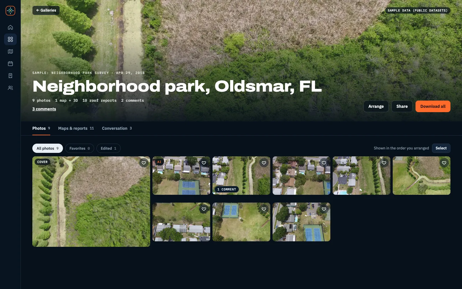
One place for the whole job
Each property or site gets its own gallery: the photos, plus any maps from the same flight.
- Favorite your picks, then download just those, or select any set
- Comment on a photo or ask for a change, and we get it right away
- Set the order and the cover photo yourself
- Share a view-only link with sellers, owners or your team
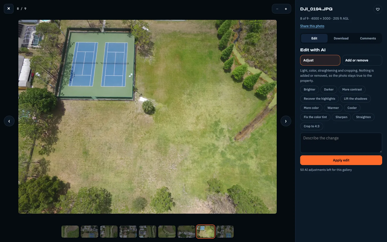
Photos, ready for the listing
Download any photo in the size you need, or the whole set numbered in your order, with the cover shot first.
- Original, print, web, MLS and social sizes, with the social crop chosen by you
- AI touch-ups for light and color that never add or remove anything
- Add-or-remove edits are previewed first and labeled for MLS disclosure
- Every edit is kept, so you can go back to any earlier version
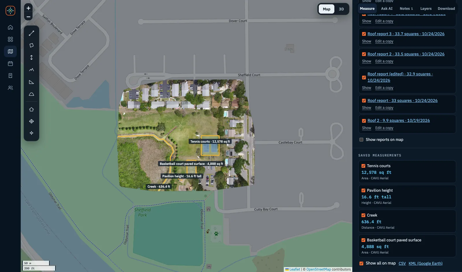
Measure from your desk
Mapping flights are stitched into one accurate aerial map with an elevation model, so you can measure without a site visit.
- Distance, area, height and elevation along a path
- Save labeled measurements for your team, and export them for spreadsheets or Google Earth
- Photo pins show where each shot was taken
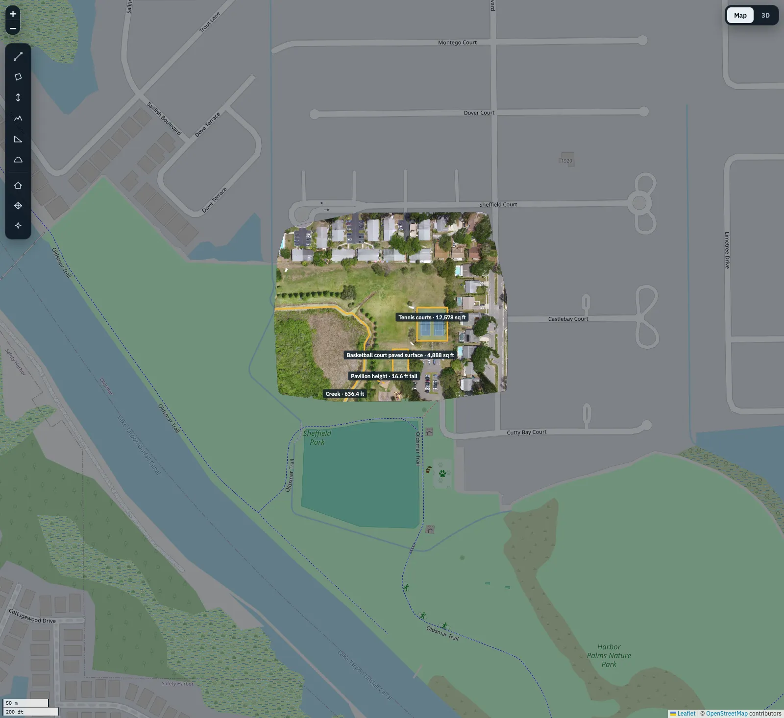
Lined up with the real world
Every map is georeferenced, so it sits in place over the street map, lined up with the roads around it.
- Download the map and elevation model as GeoTIFFs for GIS and CAD, or as a plain image
- Compare maps from different dates to track progress
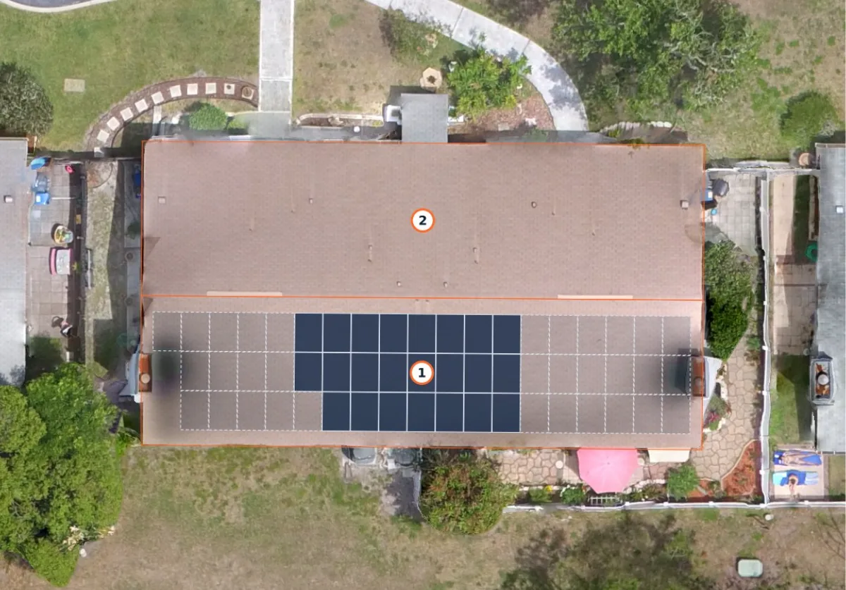
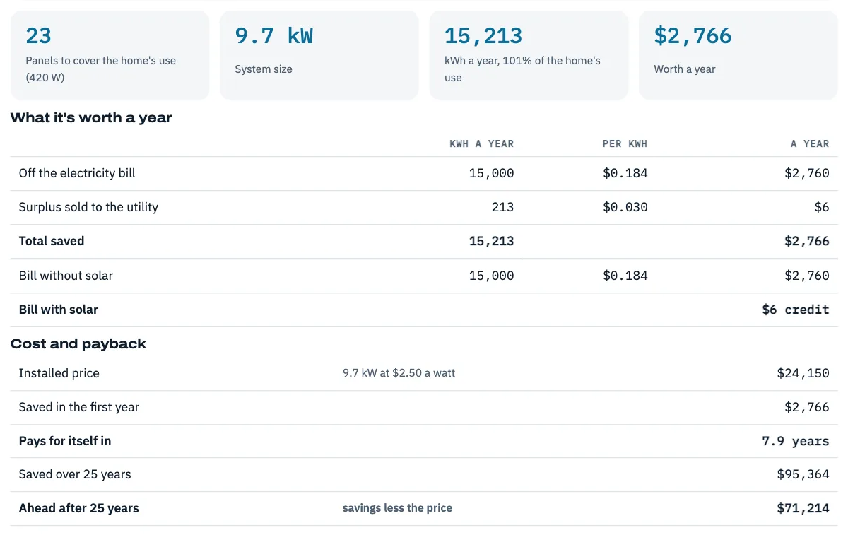
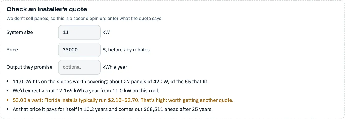
Roof and solar reports in minutes
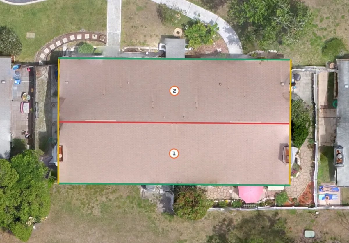
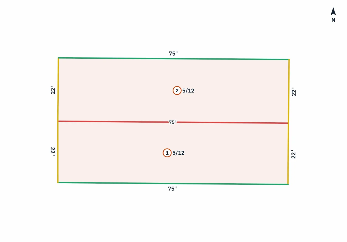
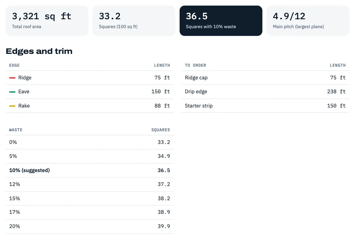
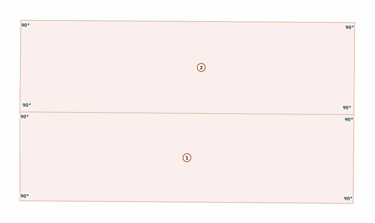
Outline each roof slope on the map and get its pitch, the direction it faces and its true sloped area, with totals in squares. Page through an example report: drag the first page to compare the drone photo with the measured diagram.
- Ridge, hip, valley, eave and rake lengths, measured along the slope
- A trim list to order from: ridge cap, drip edge, starter strip and valley lining
- Squares with suggested waste: 10%, or 15% when there are hips or valleys
- A solar estimate from a company that doesn't sell or install panels: how many fit, what they'd take off the electric bill at the home's utility rate, when they'd pay for themselves, and whether an installer's quote adds up
- Any slope that doesn't fit cleanly is flagged to check on site. Print it or save it as a PDF
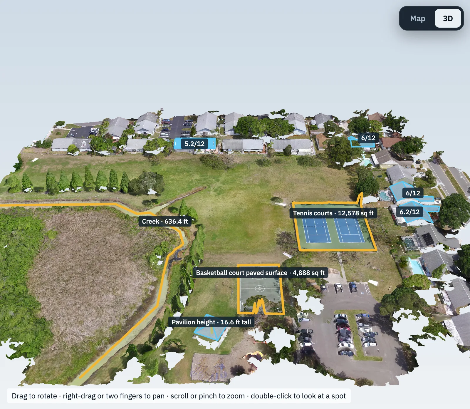
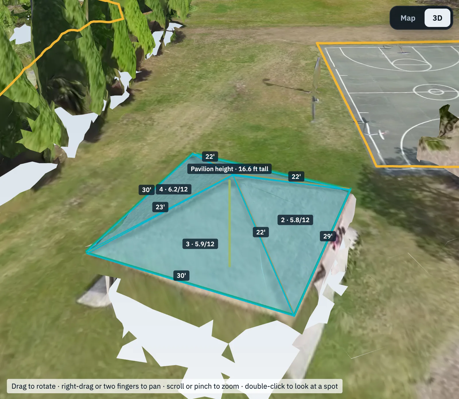
Walk around it in 3D
Mapping jobs can include a textured 3D model you rotate and zoom in the browser. No software to install. Saved measurements and roof reports show on the model too.
- Download the model for Blender, SketchUp and 3D viewers
- Point cloud for CAD and GIS
Screenshots use a public-domain sample flight over a park in Oldsmar, FL, from the OpenDroneMap project, not a CAVU Aerial job. Measurements are estimates for planning, not a licensed survey.
Packages
Straightforward pricing
Listing Essentials
$199
- 15 edited aerial photos
- Next-day delivery
- Homes up to 1 acre
Listing Plus
$349
- 25 edited aerial photos
- 60–90 second video with music
- Vertical cut for social posts
- Add a map and 3D model: +$99
Roof Report
$179
- Every slope, close detail
- Measured report: squares, pitch, edges and a trim list
- Solar estimate: panels that fit, bill savings and payback (we don't install)
- PDF photo report, same or next-day
- Add a map and 3D model: +$99
Site Monitoring
$400 /MO
- Monthly flight, fixed angles
- Photos, video and an ortho map
- Add weekly flights as needed
Site Map
$449
- Aerial map, elevation and 3D model
- Measure, save and export in your portal
- Stockpile volumes
- Up to 10 acres, then $20 an acre
Travel beyond 25 miles and larger properties are quoted separately.
Desktop roof report
Need roof numbers today? $20.
Measured from public lidar and county aerial photos, with no flight: squares, pitch per slope, ridge, hip, valley and eave lengths, a trim list and a solar estimate, in your own client portal.
Thinking about solar? The report shows how many panels fit, what they'd save on the electric bill at the home's own utility rate, and whether an installer's quote adds up. We don't sell or install panels, so it's a straight answer.
When you want current photos and a close look at the roof's condition, book a drone roof report within 30 days and the $20 comes off, if the property is one we can fly. The $20 pays for the desktop report itself, so it isn't refunded if we can't.
Why a pilot
Same rules as a pilot in the cockpit.
Most drone operators only hold the remote pilot certificate. Our pilots are also licensed private pilots, so we plan drone jobs the way pilots plan flights: airspace, weather and the plan are sorted before we get to the property.
- Near the airport is fineWe get FAA authorization for controlled airspace, which covers many neighborhoods other operators turn down.
- Weather calls you can trustIf wind or light will hurt the shots, we'll reschedule ahead of time so you're not stuck with a bad set.
- Paperwork readyInsurance certificate, flight logs and airspace approvals are available for any job.
How it works
From booking to delivery
Book
Pick a package, the address and a time that works, right here.
Plan
We check airspace, get authorization if it's needed and watch the forecast.
Fly
Usually 30–60 minutes on site. You don't need to be there.
Deliver
Edited files arrive in your client portal, usually the next day.
Book a shoot
Pick a time that works.
Choose a package and a time, or two. It's a request: we confirm within one business day, after checking the weather and the airspace. Something custom? Choose "Something else" and we'll reply with a price.
Blog
Notes from the field
Inside the client portal: what you get with every job
A tour of everything that comes with a job: galleries and downloads, AI edits, share links, maps you can measure, reports, booking and invoices.
Read the article →Desktop roof reports: roof measurements without a flight
How we measure a roof from public lidar and aerial photos, what the report includes, and when a drone roof report is the better choice.
Read the article →Thermal roof imaging: what it finds and how it works
Wet insulation under a flat roof stays warm after sunset. How a thermal drone finds it, when it works and when it doesn't, and what our thermal survey includes.
Read the article →FAQ
Common questions
Can you fly near the airport?
Usually, yes. Most controlled airspace can be approved through LAANC in minutes. A few spots need an FAA waiver that takes longer, and we'll tell you up front if that applies.
What happens if the weather is bad?
We watch the forecast and reschedule ahead of time for wind, rain or flat gray light. There's no charge for weather reschedules.
Do I need to be there?
No. For listings, we only need the address and confirmation that the sellers know a drone will be overhead.
Do you install solar panels?
No. We estimate: how many panels fit the roof, what they'd make with the shade around it, what they'd take off the electric bill and when they'd pay for themselves. We don't sell or install panels, so the numbers aren't a sales pitch, and the report can check an installer's quote.
Are you insured?
Yes, we carry liability insurance. We can send a certificate of insurance naming your company before the job.
How do I get the files?
In your own client portal. Sign in with your email, no password, and download full-resolution, MLS, web or social sizes. You can use them for the listing and your own marketing, and share a view-only link with sellers or your team.